Tirutturaipundi Fm
Type Locality and Naming
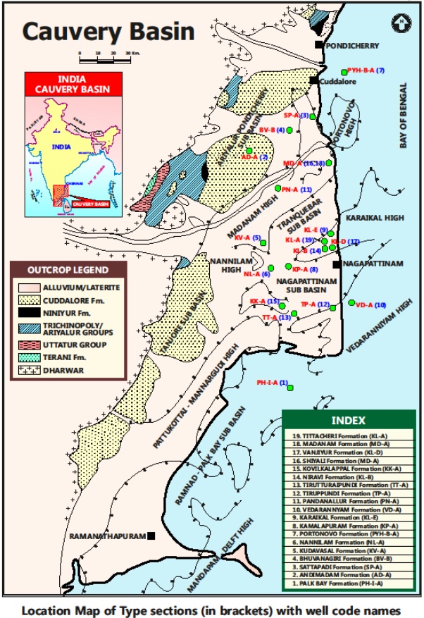
SUBSURFACE: The type section is located at exploratory well Tirutturaipundi-A (depth interval: 1000-365 m), on the Devakottai-Pattukottai Ridge of Nagapattinam subbasin. The hypostratotype is in the well PH-I-A (depth interval: 1271-435 m). It was named after the Tirutturaipundi village by ONGC team steered by Venkatarengan et al.(1993) and issued as Document-VII by KDMIPE, ONGC, Dehradun (1993).
[Figure 1: Type-section Map of Subsurface Formations]
Lithology and Thickness
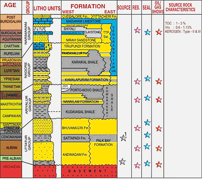
Sandstone. Mainly sandstone with alternations of minor limestone beds. The sandstone is yellow to brown and gray, medium- to coarse-grained with floating pebbles, subangular to subrounded, moderate to poorly sorted and fossiliferous, with bands of light gray, compact siliceous limestone. Its thickness varies from 438-658 m. Part of Narimanam Gr.
[Figure 2: Generalized Stratigraphy and Petroleum System of Cauvery Basin (from dghindia.gov.in)]
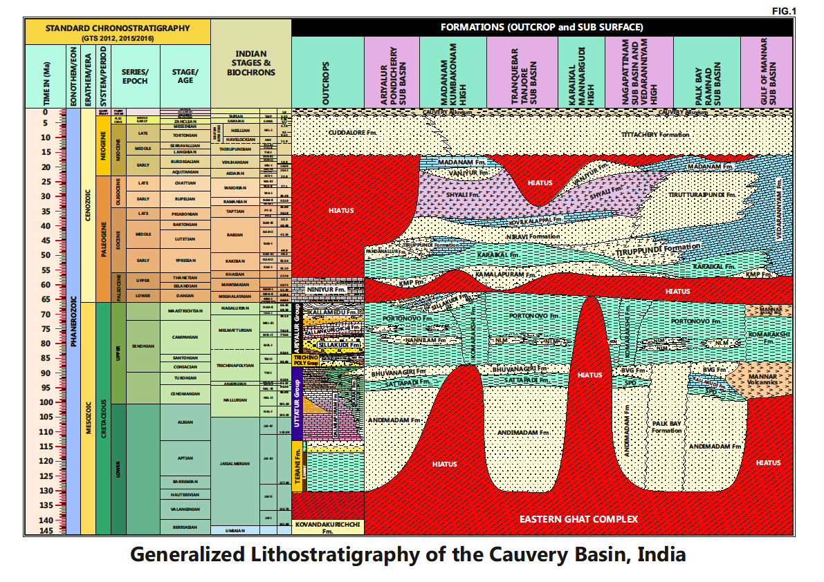
[Figure 3: Generalized Stratigraphy of Cauvery Basin (Provided by A. Nallapa Reddy & R. Nagendra)]
Relationships and Distribution
Lower contact
Unconformable with the Karaikal Fm / Tirupundi Fm / Kamalapuram Fm.
Upper contact
Conformable with the Madanam Fm /Tittacheri Fm.
Regional extent
It is present in the southern part of the Nagapattinam sub-basin extending towards the Palk Bay sub-basin, where its main depocenter lies.
GeoJSON
Fossils
Myogipsinoides complanata-formosaensis, Nummulites fichteli, Globigerina sastrii and Chiliguembelina cubensis.
Age
Depositional setting
Inner-Middle neritic.
Additional Information
This litho-unit was first recognized by R. P. Rao et al. (1971)(Progress report on studies in Cauvery Basin (Field season 1) 70-71, unpublished ONGC report), and Venkatarengan et al. (1993) have adopted it later.


